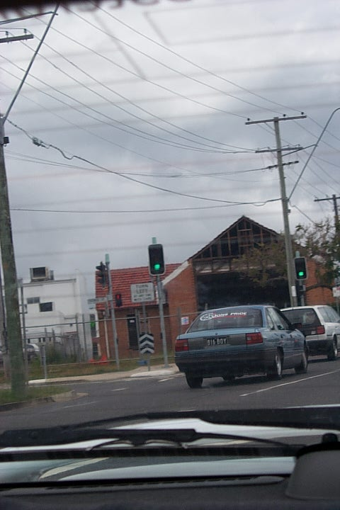
A photo I took on December 27th, 2002 at 11:49am… but where?
I believe its on the northside of Brisbane as we were visiting someone out that way and an hour or two later I took a photo of JB Hifi at Chermside, but buggered if I can work out where this is exactly.
Did a lap down Gympie Road using Google Streetview but its not old enough. Nothing looks exactly right anyway.
COULD have been from the southside as we lived in Mount Gravatt at the time, so really anywhere between there and Chermside’ish via main roads I guess.
Apologies for the photo quality. It was 2002. Digital cameras weren’t much chop back then.
I’ve uploaded the original file (and a few from afterwards which are definitely from the Northside, EXIF data shows they were taken a few hours later) here in case another pixel or two can be gleaned from the original: https://www.palad.in/uploads/aussie.zone/mystery-location-2002/
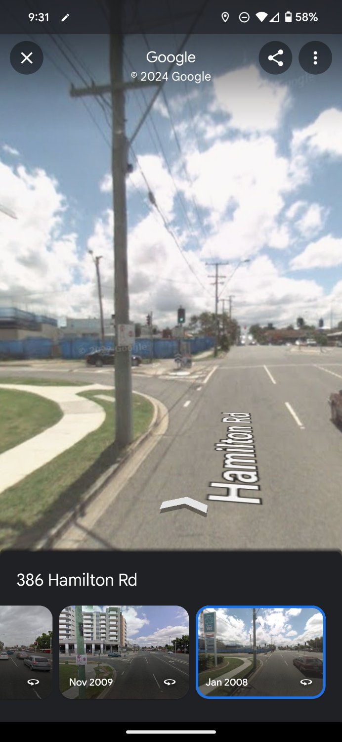
My best guess is the corner of Thomas Street and Hamilton Road Chermside, taken from the right hand turn lane into Westfield. Street View only goes back to 2008 when the apartment block that is now on that corner was being built.
I reckon you’ve nailed it mate, good one!
The power poles line up perfectly, right down to the slightly jaunty angle of that bottom rung.
If Lemmy had the equivalent of Gold I’d totally guild that post. Dunno what the alternative is… An emoji just doesn’t seem to cut it 🏆
That was bugging me no end not being able to remember where that was, thanks so much for solving the riddle.
My first instinct was to say Gympie Rd even before I saw any of the text explaining the location. But at the same time, I can’t think of where on Gympie it’d be. I can’t think of where there’s a shed like that, or a slip lane—Gympie doesn’t have too many of those coming off it.
In 2002 I lived just up from Gympie Rd and traversed it daily. Will send the photo to my parents and see if they have a better idea.
It reminded me so much of the Rode Road / Gympie Road intersection sort of area, but that church on the corner has been there since 2001 so there went my initial great theory.
Is this full resolution? There’s a street sign in the background
Unfortunately yes, looks like I was saving them in a pretty low resolution to save space (not that high resolution was much better on those cameras at around the equivalent of 1080p).
That’s fair, i expected that.
I can’t help I’m sorry
Have uploaded the original file and a few from afterwards which are definitely Northside here:
https://www.palad.in/uploads/aussie.zone/mystery-location-2002/
Yeah shame its so blurry.
But the commies number plate is Big Boy hahah
Is that JB Hi-Fi where the Chemist Warehouse and Totally Workwear are now, opposite the Westfield?
Pretty sure that’s the old JB Hifi in Suez Street just off Stafford Road.
https://maps.app.goo.gl/ZngLxcWNKCZKcTaU7
You need to set Street View back to 2009 to see it when it was still JB Hifi. The low wall to the left of the entrance is visible in both photos.
I tried but I feel bad that this didn’t ring any bells for me after my 12 years in Brissie.
Heh if there was a way you could submit to GeoGuessr you might get a lead. Especially GeoRainBolt; he’s a freak for this.
Fourth photo is Sangate Road outbound near the corner of Robinson Road.
