

You must log in or register to comment.
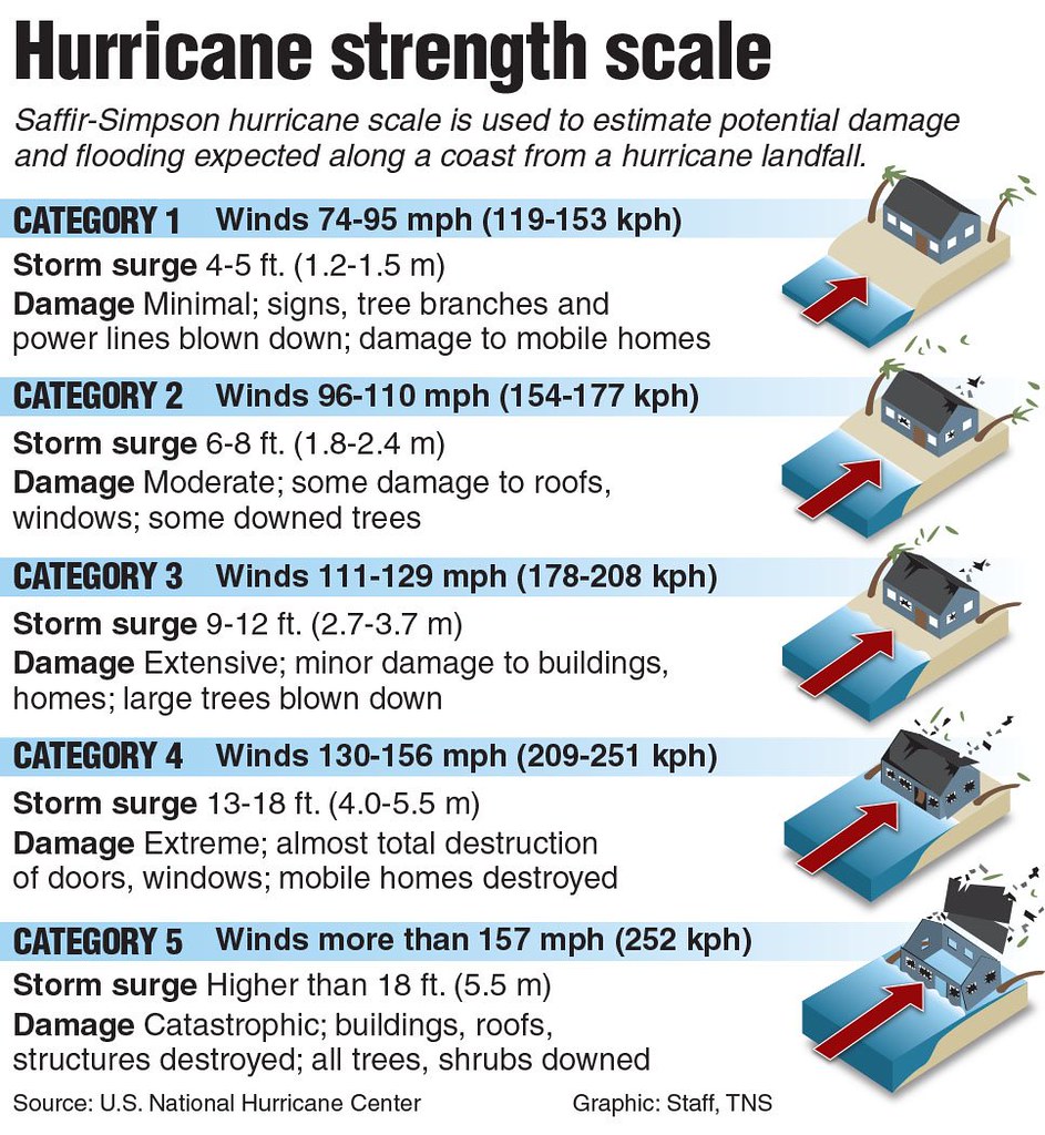
That’s not a fair picture, but it does give a rough idea. There are a many major factors that count.
- Proximity to coast. Just a few miles can make a dramatic difference.
- Relation to eye wall is huge. Hurricanes rotate widdershins. One side carries the full force of the hurricane, as bad as it gets. By the time winds and rain rotate to the other side, things have calmed a bit. Which “side”? Depends, could be any cardinal compass point. For me, getting the eye wall to the west is the worst. For Milton, people on the south side are going to take it in the teeth.
- ^ Much the same for storm surge. (I may be off on this one.)
- Speed of the hurricane. If it sits on you and slowly dumps rain, you’re flooded. The longer those winds sit on you, the more stress on structures.
- Building codes. We Floridians have strong building codes, varies a little depending on how far inland you are. I’m guessing other states to the north aren’t as strict?
tl;dr: Don’t put too much stress on this scale, though it’s a useful metric to see what might happen.
Just a heads up to this community that I am getting errors accessing the image due to too many requests. Might be an instance problem, due to being a popular post given current events.
I have been away for some weeks for holidays. Has this happened often?
Occasionally, will ping you next time.
Thanks!
isn’t this scale problematic when a storm surge is about to cause havoc in Florida, that is negatively correlated with wind speed?
